


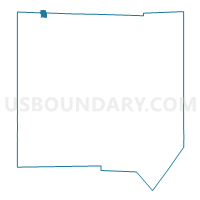
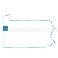
JAMESTOWN Voting District, Mercer County, Pennsylvania
About
Outline

Summary
| Unique Area Identifier | 661135 |
| Name | JAMESTOWN Voting District |
| County | Mercer County |
| State | Pennsylvania |
| Area (square miles) | 0.84 |
| Land Area (square miles) | 0.83 |
| Water Area (square miles) | 0.01 |
| % of Land Area | 99.35 |
| % of Water Area | 0.65 |
| Latitude of the Internal Point | 41.48410830 |
| Longtitude of the Internal Point | -80.43724510 |
Maps

Graphs
Select a template below for downloading or customizing gragh for JAMESTOWN Voting District, Mercer County, Pennsylvania


Neighbors
Neighoring Voting District (by Name) Neighboring Voting District on the Map
- GREENE TWP Voting District, Mercer County, PA
- SOUTH SHENANGO TWP Voting District, Crawford County, PA
- WEST SHENANGO TWP Voting District, Crawford County, PA
Top 10 Neighboring County Subdivision (by Population) Neighboring County Subdivision on the Map
- South Shenango township, Crawford County, PA (2,037)
- Greene township, Mercer County, PA (1,091)
- Jamestown borough, Mercer County, PA (617)
- West Shenango township, Crawford County, PA (504)